


 6 / 185

7
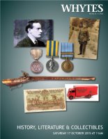
1610 Speed, John, The Province of Connaught:
With the Citie of Galwaye described. Printed map with
contemporary hand colouring. Cropped within the
plate-mark.
14_ x 19_in. (37.47 x 50.17cm)
Estimate €500-€700 £370-£510
Large Image & Place Bid 78
17th Century Map, John Speed, Leinster
The Countie of Leinster with the Citie Dublin Described.
Early colouring. Unframed.
16 x 20in. (40.64 x 50.80cm)
Estimate €250-€300 £180-£220
Large Image & Place Bid 89
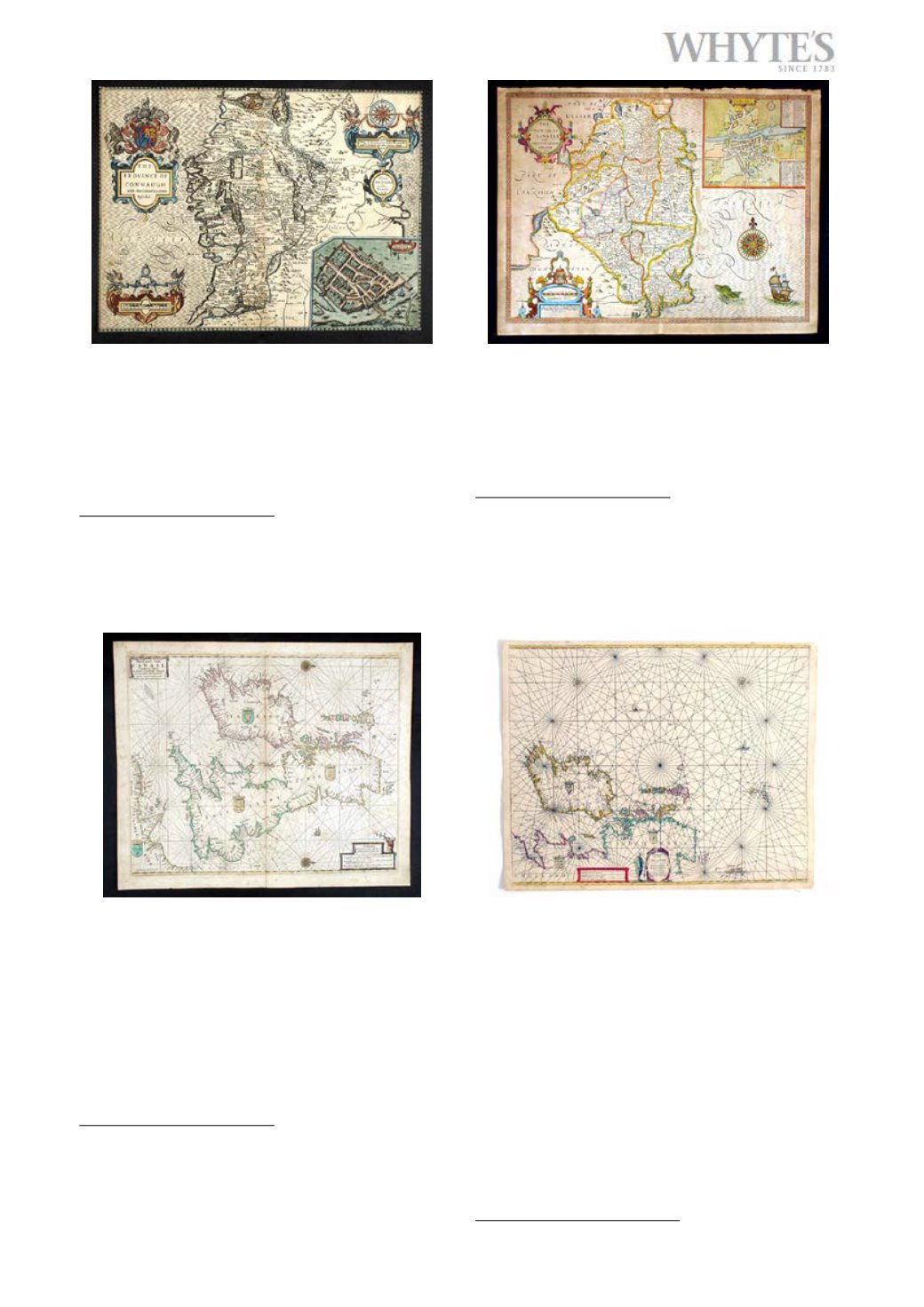
17th Century Sea Charts.
Four various charts: Goos, Pieter. Britain and Ireland.
1669. Contemporary hand colouring; The Bordeaux estu-
ary and Gascony coast, contemporary hand colouring; A
Chart of the Sea coasts of Barbary from the Straits Mouth
to the Cape de Verde, hand coloured; Collins, Greenville.
The Islands of Orkney. (4) Various sizes, the largest
19_ x 26in. (50.17 x 66.04cm)
Estimate €450-€500 £330-£370
Large Image & Place Bid 910
1690 Sea Charts of Ireland and the Thames Estu-
ary and Essex coast.
By Jacobsz, Anthonie (Theunis) early colouring, un-
framed. (2)
Anthonie Jacobsz founded a printing and publishing
business in Amsterdam in which he specialized in the
production of pilot books and sea atlases. As he died at a
comparatively early age most of the numerous editions
of his works appeared after his death published by his
sons, Jacob and Caspar, who took the name ‘Lootsman’
(sea pilot) to distinguish them from another printer of
the name Jacobsz
18 x 22in. (45.72 x 55.88cm)
Estimate €150-€200 £110-£150
Large Image & Place Bid 10