


 199 / 298

Maps & Charts
515
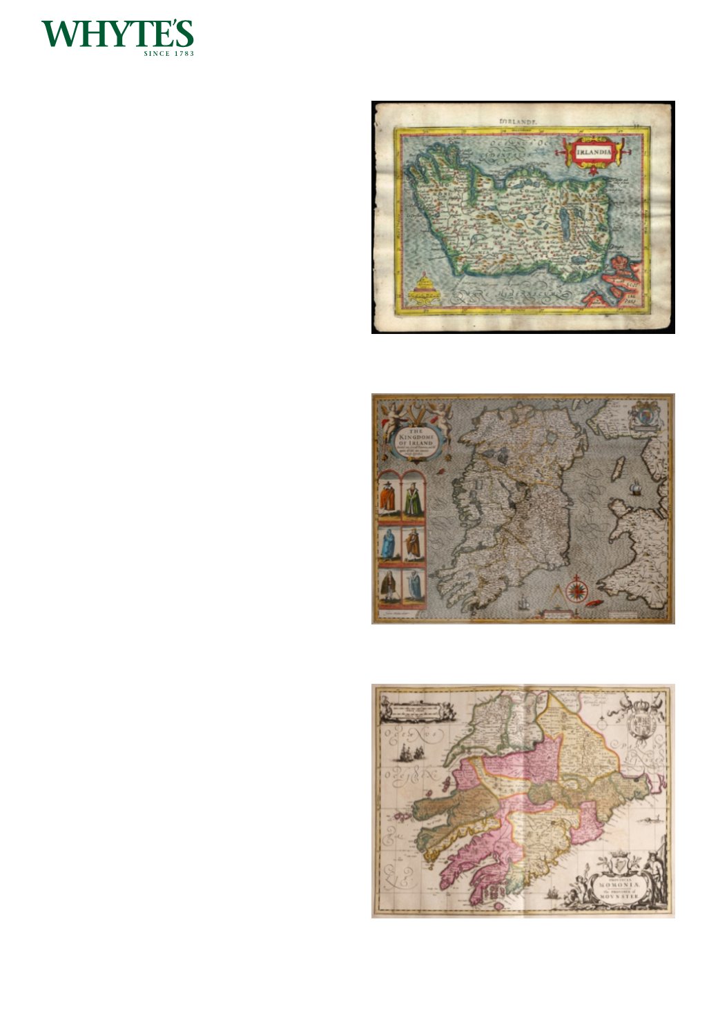
1630 Ireland and Southern Ireland, two maps
from Gerhard Mercator’s Atlas Minor.
Two hand-coloured engraved maps, from the French
edition. Each sheet
6.50 by 8.50in. (16.5 by 21.6cm)
Estimate €250-€300 (approx £212-£255)
Click Here for Large Images & To Bid 515516
1632 Map of Ireland by John Speed.
A hand-coloured, engraved map, The Kingdom of
Ireland, published in the 1632 edition of his Theatre
of the Empire of Great Britain, Framed in a double
sided frame.
15.50 by 20.25in. (39.4 by 51.4cm)
Estimate €1000-€1500 (approx £850-£1275)
Click Here for Large Images & To Bid 516517
17th century Map of Munster by Pieter Schenk &
Gerard Valck.
A hand-coloured engraved map, Provincia
Mononiae, The Province of Mounster. Published
in Amsterdam after Janssonius’ atlas of 1647,
unframed, sheet size
20.50 by 25.50in. (52.1 by 64.8cm)
Estimate €150-€200 (approx £127-£170)
Click Here for Large Images & To Bid 517