


 202 / 298

THE ECLECTIC COLLECTOR · 6 MAY 2017 AT 10AM
Maps & Charts
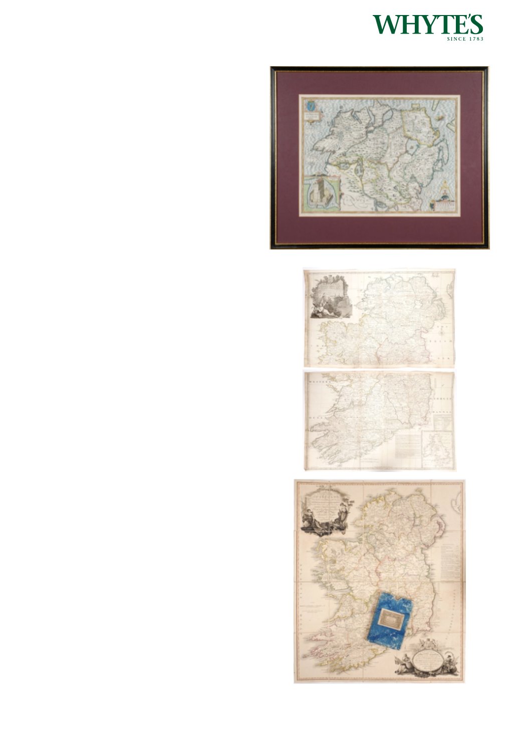
522
1759 Plans of the Principal Ports, Towns and
Harbours of Ireland for Mr Tindall’s Continuation
of Mr Rapin’s History.
An uncoloured engraving of the sixteen principal
ports, forts, cities and towns of Ireland, framed.
16.50 by 20.50in. (41.9 by 52.1cm)
Estimate €120-€180 (approx £102-£153)
Click Here for Large Images & To Bid 522523
Circa 1760 Map of Ireland, by John Rocque
The Kingdom of Ireland Divided into
Provinces Counties and Baronies. Showing the
Archbishopricks, Bishopricks, Cities, Boroughs,
Market Towns, Villages, Barracks, Mountains, Lakes,
Bogs, Rivers, Bridges, Ferries, Passes... With large
decorative title cartouche in top left corner and
inset map of the sea coasts of Great Britain and
Ireland bottom right. A very large engraved map,
printed on 4 sheets, In two sections North & South.
Colouring to the county and provincial borders.
Unframed. The larger (Southern) section
25.25 by 39in. (64.1 by 99.1cm)
Estimate €350-€450 (approx £297-£382)
Click Here for Large Images & To Bid 523524
1793 Map of Ireland by Alexander Taylor.
A hand-coloured, engraved, linen backed map in
sections, A New Map of Ireland. Having the great
features of the country described in a manner highly
expressive and the distances between the towns
&; stages marked in miles and furlongs for the use
of travellers / by Alexander Taylor Lieutenant in
his Majesty’ s Royal Engineers. Published Dublin
1793. Housed in original cardboard pouch. Bearing
retailer’s label for Allen’s Map and print Warehouse,
Dame Street, Dublin.
29.50 by 25in. (74.9 by 63.5cm)
Estimate €300-€500 (approx £255-£425)
Click Here for Large Images & To Bid 524