


 214 / 298

THE ECLECTIC COLLECTOR · 6 MAY 2017 AT 10AM
Maps & Charts
560
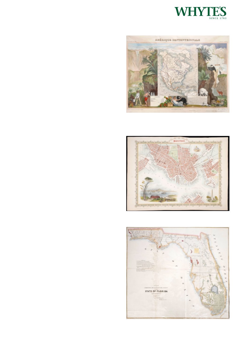
1845 Illustrated map of North America.
A hand-coloured. engraved map of North America
(Amerique Septentrionale), by Levasseur, Atlas
Universel Illustre, Paris, ca. 1845. North America
showing the United States` claims into present-day
Canada reflecting the Oregon boundary dispute.
The Republic of Texas is shown, and Mexico`s
northern border is drawn according to the Treaty
of 1819 (here misprinted as 1810). The map is
surrounded by beautifully engraved scenes of
North and Central America including wildlife, a ship
stranded in the polar sea and a Mayan temple.
13.50 by 17.50in. (34.3 by 44.5cm)
Estimate €200-€300 (approx £170-£255)
Click Here for Large Images & To Bid 560561
19th Century maps of North America, Texas,
Boston and NewYork
Six unframed, hand coloured maps including 19th
century maps of the USA and British North America
published by Archibald Fullerton (3) and Johnstone
and Johnston; and city plans of Boston by Tallis and
New York by Lett. (6) The largest sheet
25.75 by 21.25in. (65.4 by 54cm)
Estimate €200-€250 (approx £170-£212)
Click Here for Large Images & To Bid 561562
19th Century maps of North America, Florida,
Texas and Boston
Six unframed, hand coloured maps including an
1850s map of The Surveys in the State of Florida;
19th century maps of the USA and British North
America published by Archibald Fullerton (3) and
Blackie and Son (1); and a city plan of Boston by
Tallis. The largest sheet
23 by 26in. (58.4 by 66cm)
Estimate €250-€300 (approx £212-£255)
Click Here for Large Images & To Bid 562