


 212 / 298

THE ECLECTIC COLLECTOR · 6 MAY 2017 AT 10AM
Maps & Charts
554
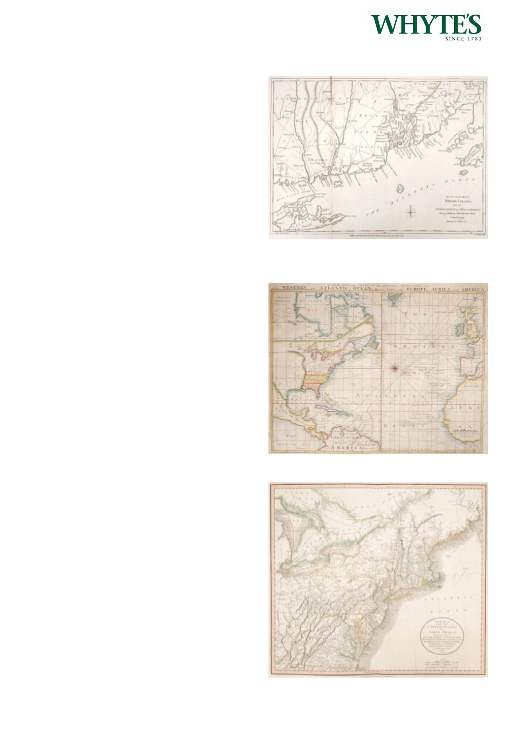
1790 Map of Rhode Island.
An engraved map, published by J. Bew, Paternoster
Row; An Accurate Map of Rhode Island, Part of
Connecticut and Massachusetts, showing Admiral
Arbuthnot’s Station in blocking up Admiral Ternay,
uncoloured, unframed.
11.25 by 15.25in. (28.6 by 38.7cm)
Estimate €300-€500 (approx £255-£425)
Click Here for Large Images & To Bid 554555
1781 Map or Chart of the Atlantic Ocean.
A hand-coloured engraved map, A new map or
chart in Mercators projection of the Western or
Atlantic Ocean, with part of Europe, Africa and
America, published by John Bew, 1781.
16.50 by 21in. (41.9 by 53.3cm)
Estimate €300-€500 (approx £255-£425)
Click Here for Large Images & To Bid 555556
1808 Map of the North Eastern Seaboard of the
United States.
A hand-coloured engraved map, A New Map of Part
of the United States of North America, containing
those of New York, Vermont, New Hampshire,
Massachusetts, Connecticut, Rhode Island,
Pennsylvania, New Jersey, Delaware, Maryland and
Virginia from the latest Authorities. by John Cary,
Published by New Universal Atlas. 1808.
20.50 by 23in. (52.1 by 58.4cm)
Estimate €250-€350 (approx £212-£297)
Click Here for Large Images & To Bid 556